
Geospatial data analysis with the help of modern software systems and artificial intelligence will have a huge impact on the development of a number of industries thanks to effective Earth observations.
These include land use, agriculture, weather forecasting, climate modeling, geophysical modeling, wildlife protection, water pollution tracking and prevention, illegal fishing monitoring, economic forecasting, and many others.
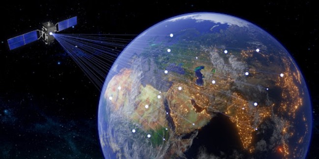
Satellite data is an unmatched source of information for those spheres, providing insights that would be impossible to gather and analyze in any other way.
Satellite Analytics Applications
Earth observation satellites are a source of enormous amounts of information. To find out more on how they can alter industries, see on the website. Previously, it was either technically impossible or too expensive to collect such data.
It was very difficult to obtain data about a specific geographic location that was up-to-date and regularly updated enough to make accurate and reliable long-term observations.
In the field of rare species protection, the combination of AI and inexpensive real-time satellite data could be the basis for a breakthrough in detecting the illegal wildlife trade.
In addition, satellite data can be used to predict and track pollution, the potential sources of which are known in advance, and to develop early warning systems for environmental disasters.
Without Earth observation satellites, consistent real-time monitoring of the vast oceans is impossible, and the availability of such data will lead to significant shifts in this area.
Monitoring and denouncing illegal fishing, tracking and predicting contamination of water bodies, and automating the fish catch threshold will all be made possible by new technologies.
On land, geospatial data analytics can help automate land-use management, monitor illegal activities or to ensure that legal activities are carried out strictly within agreed limits.
In climate modeling and weather forecasting, of course, satellite data have long been used, but cheaper and smaller satellites will make regional forecasts more accurate: taking into account local microclimates and geological subtleties.
They could also be used for geophysical analysis in the fuel industry, combining new data with seismic information collected on the ground.
The stock market, too, is likely to benefit from the combination of small satellites and artificial intelligence. For example, if you look at the occupancy rate of the parking lots at the stores of a particular retail chain, you can make a prediction about the dynamics of its stock price in the current quarter.
The same can be done to calculate attendance at a movie or sporting event, to get large-scale data on cities and transportation routes.
Processing Satellite Imagery
Human vision is limited. We observe only the visible parts of the spectrum. In contrast to our vision, satellite sensors record different kinds of radiation. Properties of an object and their color exist not only in the visible part of the spectrum, but also in all other parts.
Each of the elements in a different part of the spectrum reflects differently. Remote sensing is based not only on what people see, but also on what the human eye cannot see.
For example, at different wavelengths, the atmosphere is not transparent everywhere. The imaging equipment shoots in all spectral zones simultaneously. In the infrared range, water absorbs all radiation, so all water objects filmed in this range are dark.
Thus, geographers and researchers get information about all water bodies. Satellite data is usually analyzed and processed with the help of ML algorithms to identify objects, shapes, and analyze changes.
Today, thanks to the development of satellites, their quantity, and the improvement of ML algorithms, it’s possible to perform almost real-time geospatial data analysis.
Using Satellite Data And Analytics In Industries
First of all, satellite data is a valuable source of information when it comes to emergencies: forest fires, floods, man-made disasters. It is the means and methods of remote sensing that make it possible to respond promptly.
With the help of satellites it is possible to regularly monitor a certain area and receive up-to-date information. For example, an infrared camera can see burnt-out areas, everything under clouds, and fire points.
The captured image allows experts to establish where fires are occurring, their movement and dynamics. It is impossible to see all this with the human eye.
Another issue satellites are monitoring concerns deforestation. Data acquired by space imagery enables controlling legality/illegality, logging dynamics and forest maintenance and rehabilitation process.
One of the biggest industries where satellite data is applied is agriculture. Geospatial data analysis in agriculture allows for observing fields from space, so the growers can see how crops develop in each area of the field and at every growth stage.
Based on this information, they can make reliable decisions on inputs application and other activities in the field. For instance, EOSDA has developed a software product specifically for smart farming based on satellite data analysis. EOSDA Crop Monitoring is a digital tool that offers a set of features for remote and effective fields management in one place.
Conversion of Satellite Data Into Useful Information
One example of how satellite data converts into invaluable information is the research EOSDA has performed regarding the issue of illegal gold mining in Brazil.
As part of this social case, the company has used its EOSDA Crop Monitoring platform to collect data from 2017 through 2022 to see how the situation has changed in the studied area since the miners came there.
For this purpose, the company’s team has compared satellite images based on the NDVI — a vegetation index that allows for visualizing the density and the greenness of plants’ green biomass in the area.
It has enabled the company to identify zones where deforestation has occurred, leaving only bare soil or new roads created by miners. Thus, the company was able to calculate the exact area that was deforested in the span of five years.
Ultimately, satellite data is an unmatched source of information when it comes to observation and management of large and remote areas, since no other method of research can compete with it in terms of scalability.
And the more satellite technology develops alongside AI algorithms, the more possibilities this method of data acquisition and processing can offer.